
Sentosa Cove topographic map
Interactive map
Click on the map to display elevation.
About this map
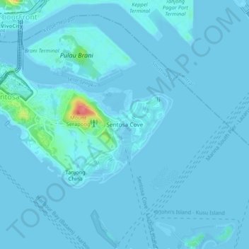
Name: Sentosa Cove topographic map, elevation, terrain.
Location: Sentosa Cove, Southwest, 98537, Singapore (1.22811 103.82061 1.26811 103.86061)
Average elevation: 4 m
Minimum elevation: -3 m
Maximum elevation: 75 m
Other topographic maps
Click on a map to view its topography, its elevation and its terrain.
Labrador Nature Reserve
Labrador Nature Reserve, Alexandra, Sentosa Cove, Southwest, Singapore
Average elevation: 11 m
Telok Blangah Hill Park
Telok Blangah Hill Park, Alexandra, Sentosa Cove, Southwest, 109178, Singapore
Average elevation: 24 m
Southern Ridges
Southern Ridges, Siloso Road, Sentosa, Sentosa Cove, Southwest, 098270, Singapore
Average elevation: 7 m