
Fogars de Montclús topographic map
Interactive map
Click on the map to display elevation.
About this map
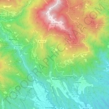
Name: Fogars de Montclús topographic map, elevation, terrain.
Location: Fogars de Montclús, Vallès Oriental, BCN, Catalonia, Spain (41.70389 2.39681 41.79061 2.48194)
Average elevation: 699 m
Minimum elevation: 159 m
Maximum elevation: 1,692 m