
Kg. Sungai Belang topographic map
Interactive map
Click on the map to display elevation.
About this map
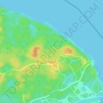
Name: Kg. Sungai Belang topographic map, elevation, terrain.
Location: Kg. Sungai Belang, North-Eastern Islands, Southeast, Singapore (1.41014 104.06073 1.43014 104.08073)
Average elevation: 13 m
Minimum elevation: -1 m
Maximum elevation: 38 m
Other topographic maps
Click on a map to view its topography, its elevation and its terrain.
Geylang River
Geylang River, Marine Parade, Southeast, Singapore
Average elevation: 9 m
East Coast Park (Zone H)
East Coast Park (Zone H), Tanah Merah, Southeast, Singapore
Average elevation: 5 m
Kg. Sanyongkong Parit
Kg. Sanyongkong Parit, North-Eastern Islands, Southeast, Singapore
Average elevation: 16 m
Pulau Tekong Camp
Singapore > Southeast > Rocky Hill
Pulau Tekong Camp, Rocky Hill, Southeast, Singapore
Average elevation: 5 m