
Ayo topographic map
Interactive map
Click on the map to display elevation.
About this map
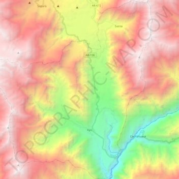
Name: Ayo topographic map, elevation, terrain.
Location: Ayo, Provincia de Castilla, Arequipa, Perú (-15.74123 -72.39064 -15.52724 -72.19432)
Average elevation: 3,402 m
Minimum elevation: 1,317 m
Maximum elevation: 5,209 m
Other topographic maps
Click on a map to view its topography, its elevation and its terrain.
Laguna Mamacocha
Laguna Mamacocha, Trekking al Mamacocha, Pumacocha, Ayo, Provincia de Castilla, Arequipa, Perú
Average elevation: 1,895 m