
Greenwood County topographic map
Interactive map
Click on the map to display elevation.
About this map
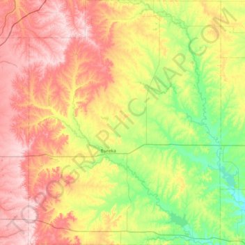
Name: Greenwood County topographic map, elevation, terrain.
Location: Greenwood County, Kansas, United States of America (37.60338 -96.52556 38.17407 -95.95884)
Average elevation: 372 m
Minimum elevation: 266 m
Maximum elevation: 507 m
Other topographic maps
Click on a map to view its topography, its elevation and its terrain.
Lawrence
United States of America > Kansas > Lawrence
Lawrence, Douglas County, Kansas, United States of America
Average elevation: 265 m
Pottawatomie County
United States of America > Kansas
Pottawatomie County, Kansas, United States of America
Average elevation: 367 m
Seward County
United States of America > Kansas
Seward County, Kansas, United States of America
Average elevation: 866 m