
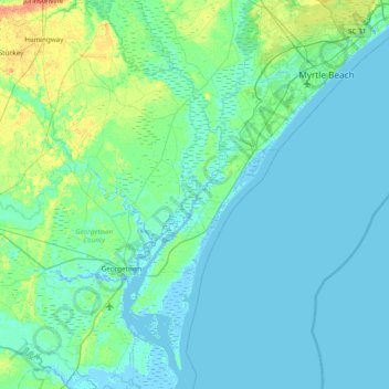
Holly Hill topographic map
Interactive map
Click on the map to display elevation.
About this map
Name: Holly Hill topographic map, elevation, terrain.
Average elevation: 5 m
Minimum elevation: -4 m
Maximum elevation: 30 m
Other topographic maps
Click on a map to view its topography, its elevation and its terrain.
Pawleys Island
United States > South Carolina > Georgetown County
Pawleys Island, Georgetown County, South Carolina, United States
Average elevation: 1 m
Murrells Inlet
United States > South Carolina > Georgetown County
Murrells Inlet, Georgetown County, South Carolina, United States
Average elevation: 2 m
Andrews
United States > South Carolina > Georgetown County
Andrews, Georgetown County, South Carolina, United States
Average elevation: 8 m
Waverly Mills
United States > South Carolina > Georgetown County
Waverly Mills, Georgetown County, South Carolina, 29585, United States
Average elevation: 3 m
Hopewell
United States > South Carolina > Georgetown County
Hopewell, Georgetown County, South Carolina, United States
Average elevation: 15 m
North Litchfield Beach
United States > South Carolina > Georgetown County
North Litchfield Beach, Georgetown County, South Carolina, United States
Average elevation: 2 m
Brookgreen Gardens
United States > South Carolina > Georgetown County > Murrells Inlet
Brookgreen Gardens, Murrells Inlet, Georgetown County, South Carolina, United States
Average elevation: 4 m
Lodge Hall
United States > South Carolina > Georgetown County
Lodge Hall, Georgetown County, South Carolina, United States
Average elevation: 8 m
DeBordieu Colony
United States > South Carolina > Georgetown County
DeBordieu Colony, Georgetown County, South Carolina, United States
Average elevation: 0 m
North Santee
United States > South Carolina > Georgetown County
North Santee, Georgetown County, South Carolina, United States
Average elevation: 6 m
Georgetown
United States > South Carolina > Georgetown County > Georgetown
Georgetown, Georgetown County, South Carolina, United States
Average elevation: 2 m
White Hall Estates
United States > South Carolina > Georgetown County
White Hall Estates, Georgetown County, South Carolina, United States
Average elevation: 3 m
Georgetown
United States > South Carolina > Georgetown County > Georgetown
Georgetown, Georgetown County, South Carolina, 29440, United States
Average elevation: 3 m
Dunbar Landing
United States > South Carolina > Georgetown County > Dunbar Landing
Dunbar Landing, Georgetown County, South Carolina, United States
Average elevation: 6 m
Country Club Estates
United States > South Carolina > Georgetown County > Georgetown > Country Club Estates
Country Club Estates, Georgetown, Georgetown County, South Carolina, 29440, United States
Average elevation: 3 m
The Reserve
United States > South Carolina > Georgetown County
The Reserve, Georgetown County, South Carolina, 29585, United States
Average elevation: 3 m
Litchfield by the Sea
United States > South Carolina > Georgetown County > North Litchfield Beach
Litchfield by the Sea, North Litchfield Beach, Georgetown County, South Carolina, 29585, United States
Average elevation: 2 m