
Zhangzhou topographic map
Interactive map
Click on the map to display elevation.
About this map
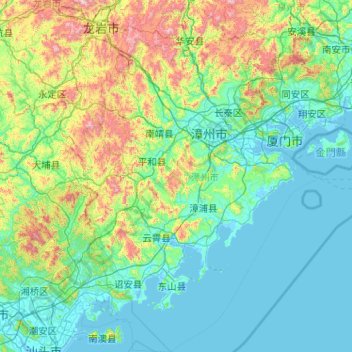
Name: Zhangzhou topographic map, elevation, terrain.
Location: Zhangzhou, Fujian, China (23.53154 116.89551 25.21020 118.15126)
Average elevation: 284 m
Minimum elevation: -2 m
Maximum elevation: 1,618 m
Other topographic maps
Click on a map to view its topography, its elevation and its terrain.