
Jever topographic map
Interactive map
Click on the map to display elevation.
About this map
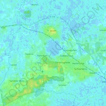
Name: Jever topographic map, elevation, terrain.
Location: Jever, Landkreis Friesland, Niedersachsen, 26441, Deutschland (53.50094 7.81521 53.60284 7.95296)
Average elevation: 3 m
Minimum elevation: -4 m
Maximum elevation: 13 m
Jever liegt in der gemäßigten Klimazone, hauptsächlich im direkten Einfluss der Nordsee. Im Sommer sind die Tagestemperaturen tiefer, im Winter häufig höher als im weiteren Inland. Das Klima ist insgesamt von der mitteleuropäischen Westwindzone geprägt.
Other topographic maps
Click on a map to view its topography, its elevation and its terrain.
Grappermöns
Deutschland > Niedersachsen > Landkreis Friesland > Jever > Sandeler Möns
Grappermöns, Sandeler Möns, Jever, Landkreis Friesland, Niedersachsen, 26441, Deutschland
Average elevation: 5 m