
Stone Lake topographic map
Interactive map
Click on the map to display elevation.
About this map
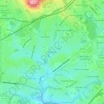
Name: Stone Lake topographic map, elevation, terrain.
Location: Stone Lake, Greenville County, South Carolina, 29609, USA (34.85401 -82.40040 34.89401 -82.36040)
Average elevation: 305 m
Minimum elevation: 265 m
Maximum elevation: 412 m