
Eysturoy topographic map
Interactive map
Click on the map to display elevation.
About this map
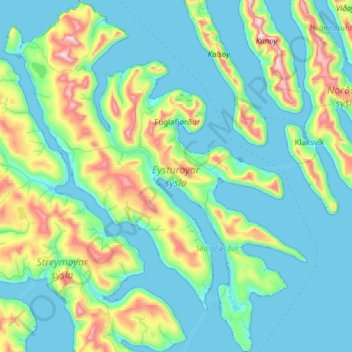
Name: Eysturoy topographic map, elevation, terrain.
Location: Eysturoy, Eysturoy region, Faroe Islands (62.05596 -7.11699 62.34175 -6.58892)
Average elevation: 162 m
Minimum elevation: -8 m
Maximum elevation: 879 m