
Poroto topographic map
Interactive map
Click on the map to display elevation.
About this map
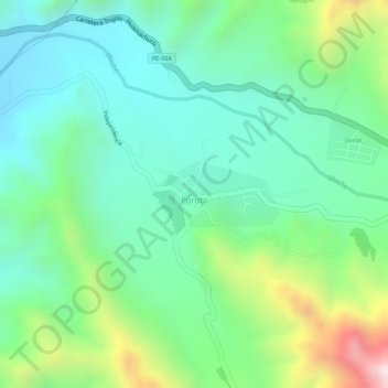
Name: Poroto topographic map, elevation, terrain.
Location: Poroto, Trujillo, La Libertad, Perú (-8.01334 -78.77098 -8.00871 -78.76198)
Average elevation: 690 m
Minimum elevation: 519 m
Maximum elevation: 1,070 m
Other topographic maps
Click on a map to view its topography, its elevation and its terrain.
Poroto
Perú > La Libertad > Poroto
Poroto, Provincia de Trujillo, La Libertad, Perú
Average elevation: 1,141 m