
Pelican Rapids topographic map
Interactive map
Click on the map to display elevation.
About this map
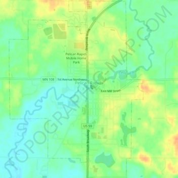
Name: Pelican Rapids topographic map, elevation, terrain.
Location: Pelican Rapids, Otter Tail County, Minnesota, USA (46.55329 -96.10452 46.58599 -96.06813)
Average elevation: 405 m
Minimum elevation: 389 m
Maximum elevation: 426 m