
Kirishima topographic map
Interactive map
Click on the map to display elevation.
About this map
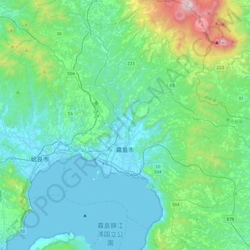
Name: Kirishima topographic map, elevation, terrain.
Location: Kirishima, Kagoshima Prefecture, 899-4394, Japan (31.60476 130.58946 31.94275 130.91409)
Average elevation: 279 m
Minimum elevation: -3 m
Maximum elevation: 1,668 m