
Dode Linge topographic map
Interactive map
Click on the map to display elevation.
About this map
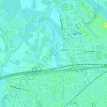
Name: Dode Linge topographic map, elevation, terrain.
Average elevation: 6 m
Minimum elevation: 2 m
Maximum elevation: 17 m
Other topographic maps
Click on a map to view its topography, its elevation and its terrain.
Kerk Avezaath
Nederland > Gelderland > Tiel
Kerk Avezaath, Tiel, Gelderland, Nederland
Average elevation: 6 m
Wadenoijen
Nederland > Gelderland > Tiel
Wadenoijen, Tiel, Gelderland, Nederland
Average elevation: 4 m
Zennewijnen
Nederland > Gelderland > Tiel > Zennewijnen
Zennewijnen, Tiel, Gelderland, Nederland
Average elevation: 6 m
Kapel Avezaath
Nederland > Gelderland > Tiel
Kapel Avezaath, Tiel, Gelderland, Nederland
Average elevation: 5 m
Linge
Nederland > Gelderland > Tiel
Linge, Tiel, Gelderland, Nederland, 4011LX, Nederland
Average elevation: 5 m