
Taiyuan City topographic map
Interactive map
Click on the map to display elevation.
About this map
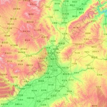
Name: Taiyuan City topographic map, elevation, terrain.
Location: Taiyuan City, Shanxi, China (37.44142 111.50892 38.42085 113.14779)
Average elevation: 1,284 m
Minimum elevation: 735 m
Maximum elevation: 2,810 m
Other topographic maps
Click on a map to view its topography, its elevation and its terrain.
Fangshan
China > Shanxi > Fangshan County > Fangshan
Fangshan, Fangshan County, Lüliang City, Shanxi, China
Average elevation: 1,383 m