
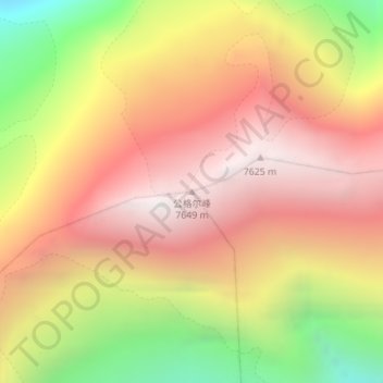
Kongur Tagh topographic map
Interactive map
Click on the map to display elevation.
About this map
Name: Kongur Tagh topographic map, elevation, terrain.
Average elevation: 6,904 m
Minimum elevation: 5,862 m
Maximum elevation: 7,645 m
Other topographic maps
Click on a map to view its topography, its elevation and its terrain.
Broad Peak
Broad Peak, Trans-Karakoram Tract, Taxkorgan Tajik Autonomous County, Kashgar Prefecture, Xinjiang, PRC
Average elevation: 7,127 m
Gasherbrum II
Gasherbrum II, Trans-Karakoram Tract, Taxkorgan Tajik Autonomous County, Kashgar Prefecture, Xinjiang, PRC
Average elevation: 7,098 m
Indira Col
Indira Col, Trans-Karakoram Tract, Taxkorgan Tajik Autonomous County, Kashgar Prefecture, Xinjiang, PRC
Average elevation: 5,699 m