
Kumberg topographic map
Interactive map
Click on the map to display elevation.
About this map
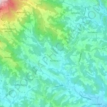
Name: Kumberg topographic map, elevation, terrain.
Location: Kumberg, Graz-Umgebung, Steiermark, 8062, Österreich (47.12888 15.50123 47.20062 15.59051)
Average elevation: 552 m
Minimum elevation: 413 m
Maximum elevation: 1,135 m