
Talanga topographic map
Interactive map
Click on the map to display elevation.
About this map
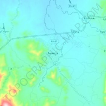
Name: Talanga topographic map, elevation, terrain.
Location: Talanga, Francisco Morazán, 0824, Honduras (14.24641 -87.24246 14.56641 -86.92246)
Average elevation: 918 m
Minimum elevation: 618 m
Maximum elevation: 1,782 m