
Zell am See topographic map
Interactive map
Click on the map to display elevation.
About this map
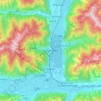
Name: Zell am See topographic map, elevation, terrain.
Location: Zell am See, Bezirk Zell am See, Salzburg, 5700, Austria (47.28200 12.73554 47.36532 12.89996)
Average elevation: 1,118 m
Minimum elevation: 742 m
Maximum elevation: 1,994 m
Other topographic maps
Click on a map to view its topography, its elevation and its terrain.
Hinterglemm
Austria > Salzburg > Bezirk Zell am See > Saalbach-Hinterglemm
Hinterglemm, Saalbach-Hinterglemm, Bezirk Zell am See, Salzburg, 5754, Austria
Average elevation: 1,392 m