
Stadt Kitzbühel topographic map
Interactive map
Click on the map to display elevation.
About this map
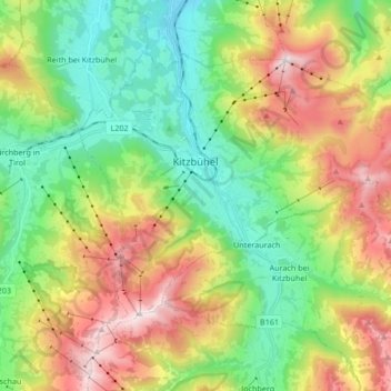
Name: Stadt Kitzbühel topographic map, elevation, terrain.
Location: Stadt Kitzbühel, Bezirk Kitzbühel, Tyrol, 6370, Austria (47.39505 12.34109 47.47793 12.50914)
Average elevation: 1,176 m
Minimum elevation: 692 m
Maximum elevation: 1,974 m
Other topographic maps
Click on a map to view its topography, its elevation and its terrain.
Marktgemeinde Fieberbrunn
Austria > Tyrol > Bezirk Kitzbühel
Marktgemeinde Fieberbrunn, Bezirk Kitzbühel, Tyrol, 6391, Austria
Average elevation: 1,245 m