
Carentan topographic map
Interactive map
Click on the map to display elevation.
About this map
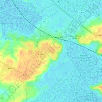
Name: Carentan topographic map, elevation, terrain.
Average elevation: 9 m
Minimum elevation: -3 m
Maximum elevation: 34 m
Other topographic maps
Click on a map to view its topography, its elevation and its terrain.
Le Haut de l'Amont
France > Normandie > Manche > Carentan-les-Marais > Saint-Côme-du-Mont
Le Haut de l'Amont, Saint-Côme-du-Mont, Carentan-les-Marais, Saint-Lô, Manche, Normandie, France métropolitaine, 50500, France
Average elevation: 7 m