
Apeldoorn topographic map
Interactive map
Click on the map to display elevation.
About this map
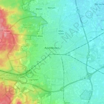
Name: Apeldoorn topographic map, elevation, terrain.
Location: Apeldoorn, Gelderland, Netherlands (52.17264 5.89264 52.25026 6.05825)
Average elevation: 23 m
Minimum elevation: 2 m
Maximum elevation: 98 m