
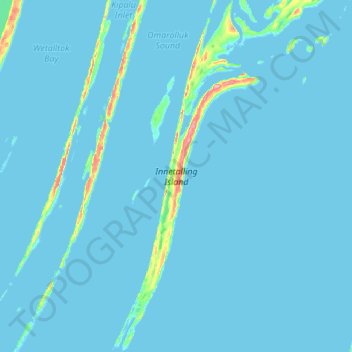
Innetalling Island topographic map
Interactive map
Click on the map to display elevation.
About this map
Name: Innetalling Island topographic map, elevation, terrain.
Location: Innetalling Island, NU, Canada (55.78337 -79.13386 56.09043 -78.90374)
Average elevation: 3 m
Minimum elevation: -5 m
Maximum elevation: 94 m
Other topographic maps
Click on a map to view its topography, its elevation and its terrain.