
漳州市 topographic map
Interactive map
Click on the map to display elevation.
About this map
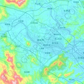
Name: 漳州市 topographic map, elevation, terrain.
Location: 漳州市, 芗城区 (Xiangcheng), 漳州市 / Zhangzhou, Fujian, China (24.34819 117.48960 24.66819 117.80960)
Average elevation: 103 m
Minimum elevation: -1 m
Maximum elevation: 898 m