
Vaal River topographic map
Interactive map
Click on the map to display elevation.
About this map
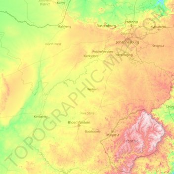
Name: Vaal River topographic map, elevation, terrain.
Average elevation: 1,432 m
Minimum elevation: 874 m
Maximum elevation: 3,428 m
Other topographic maps
Click on a map to view its topography, its elevation and its terrain.
Dr Ruth Segomotsi Mompati District Municipality
Dr Ruth Segomotsi Mompati District Municipality, North West, RSA
Average elevation: 1,234 m