
Shoshone County topographic map
Interactive map
Click on the map to display elevation.
About this map
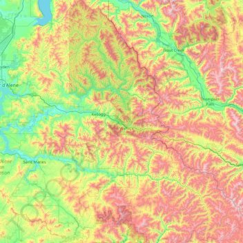
Name: Shoshone County topographic map, elevation, terrain.
Location: Shoshone County, Idaho, USA (46.93071 -116.32997 48.06772 -114.95879)
Average elevation: 1,204 m
Minimum elevation: 623 m
Maximum elevation: 2,280 m
Other topographic maps
Click on a map to view its topography, its elevation and its terrain.
American Falls
USA > Idaho > American Falls
American Falls, Power County, Idaho, 83211, USA
Average elevation: 1,345 m