
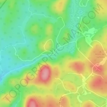
Lac-Beaudry topographic map
Interactive map
Click on the map to display elevation.
About this map
Name: Lac-Beaudry topographic map, elevation, terrain.
Average elevation: 332 m
Minimum elevation: 283 m
Maximum elevation: 397 m
Other topographic maps
Click on a map to view its topography, its elevation and its terrain.
Lac Bob
Canada > Québec > Saint-Calixte
Lac Bob, Rue Deroy, Saint-Calixte, Montcalm, Lanaudière, Québec, J0K 1Z0, Canada
Average elevation: 208 m
Lac Beaudry
Canada > Québec > Saint-Calixte
Lac Beaudry, Saint-Calixte, Montcalm, Lanaudière, Québec, Canada
Average elevation: 328 m
Lac Pinet
Canada > Québec > Saint-Calixte
Lac Pinet, Rue du Lac Pinet, Saint-Calixte, Montcalm, Lanaudière, Québec, J0K 1Z0, Canada
Average elevation: 265 m