
Albany County topographic map
Interactive map
Click on the map to display elevation.
About this map
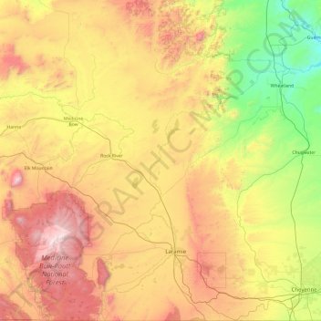
Name: Albany County topographic map, elevation, terrain.
Location: Albany County, Wyoming, United States of America (40.99702 -106.32508 42.43315 -105.27144)
Average elevation: 2,138 m
Minimum elevation: 1,323 m
Maximum elevation: 3,594 m
Other topographic maps
Click on a map to view its topography, its elevation and its terrain.
Devils Tower
United States of America > Wyoming
Devils Tower, Crook County, Wyoming, 82714, United States of America
Average elevation: 1,236 m
Hot Springs County
United States of America > Wyoming
Hot Springs County, Wyoming, United States of America
Average elevation: 1,745 m