
Lewis County topographic map
Interactive map
Click on the map to display elevation.
About this map
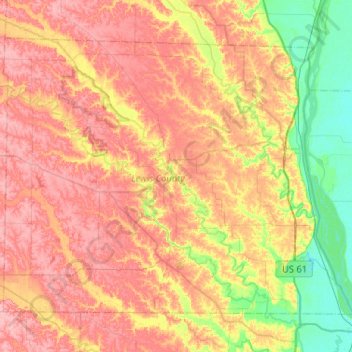
Name: Lewis County topographic map, elevation, terrain.
Location: Lewis County, Missouri, United States of America (39.94803 -91.95487 40.25885 -91.43836)
Average elevation: 189 m
Minimum elevation: 141 m
Maximum elevation: 231 m
Other topographic maps
Click on a map to view its topography, its elevation and its terrain.
Webb City
United States of America > Missouri > Webb City > Webb City
Webb City, Jasper County, Missouri, United States of America
Average elevation: 304 m