
Woodbury County topographic map
Interactive map
Click on the map to display elevation.
About this map
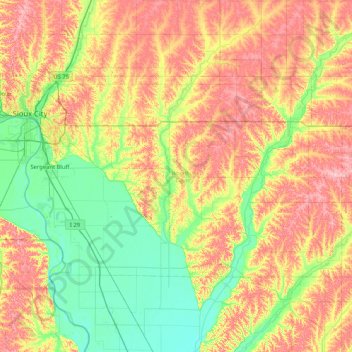
Name: Woodbury County topographic map, elevation, terrain.
Location: Woodbury County, Iowa, United States of America (42.21127 -96.49899 42.56223 -95.66915)
Average elevation: 376 m
Minimum elevation: 316 m
Maximum elevation: 460 m
Other topographic maps
Click on a map to view its topography, its elevation and its terrain.
Clinton
United States of America > Iowa > Clinton
Clinton, Clinton County, Iowa, United States of America
Average elevation: 197 m
Keystone
United States of America > Iowa > Keystone
Keystone, Benton County, Iowa, 52249, United States of America
Average elevation: 272 m