
Rivière-Pilote topographic map
Interactive map
Click on the map to display elevation.
About this map
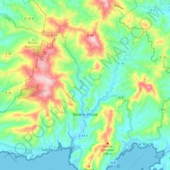
Name: Rivière-Pilote topographic map, elevation, terrain.
Location: Rivière-Pilote, Le Marin, Martinique, 97211, France (14.45736 -60.92942 14.54785 -60.86446)
Average elevation: 118 m
Minimum elevation: 0 m
Maximum elevation: 364 m