
Tanna topographic map
Interactive map
Click on the map to display elevation.
About this map
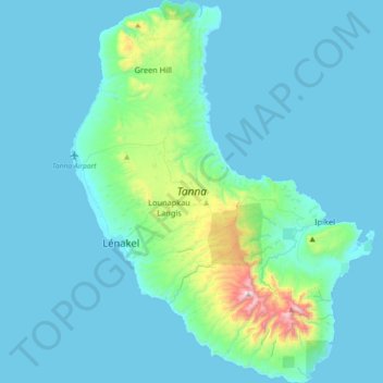
Name: Tanna topographic map, elevation, terrain.
Location: Tanna, Lénakel, Tafea, Vanuatu (-19.65582 169.22001 -19.31575 169.50710)
Average elevation: 104 m
Minimum elevation: -1 m
Maximum elevation: 1,058 m