
Sandakan topographic map
Interactive map
Click on the map to display elevation.
About this map
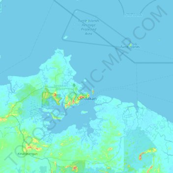
Name: Sandakan topographic map, elevation, terrain.
Location: Sandakan, Sabah, Malaysia (5.50073 117.62718 6.28333 118.35216)
Average elevation: 6 m
Minimum elevation: -4 m
Maximum elevation: 222 m
Other topographic maps
Click on a map to view its topography, its elevation and its terrain.