
Lac-Duffy topographic map
Interactive map
Click on the map to display elevation.
About this map
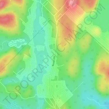
Name: Lac-Duffy topographic map, elevation, terrain.
Average elevation: 330 m
Minimum elevation: 291 m
Maximum elevation: 388 m
Other topographic maps
Click on a map to view its topography, its elevation and its terrain.
Saint-Calixte-Nord
Canada > Québec > Montcalm > Saint-Calixte
Saint-Calixte-Nord, Saint-Calixte, Montcalm, Lanaudière, Québec, J0K 1Z0, Canada
Average elevation: 346 m
Lac Rond
Canada > Québec > Montcalm > Saint-Calixte
Lac Rond, Saint-Calixte, Montcalm, Lanaudière, Québec, Canada
Average elevation: 314 m