
Narmada topographic map
Interactive map
Click on the map to display elevation.
About this map
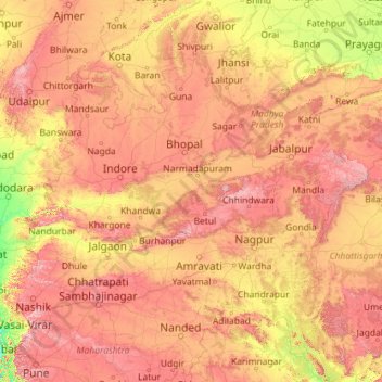
Name: Narmada topographic map, elevation, terrain.
Average elevation: 380 m
Minimum elevation: 0 m
Maximum elevation: 1,440 m
Other topographic maps
Click on a map to view its topography, its elevation and its terrain.
Cantonment
India > Madhya Pradesh > Ranjhi Tahsil
Cantonment, Ranjhi Tahsil, Jabalpur District, Madhya Pradesh, 482005, India
Average elevation: 421 m
Dhana
India > Madhya Pradesh > Tendukheda Tahsil
Dhana, Tendukheda Tahsil, Damoh District, Madhya Pradesh, India
Average elevation: 372 m