
Rhyl topographic map
Interactive map
Click on the map to display elevation.
About this map
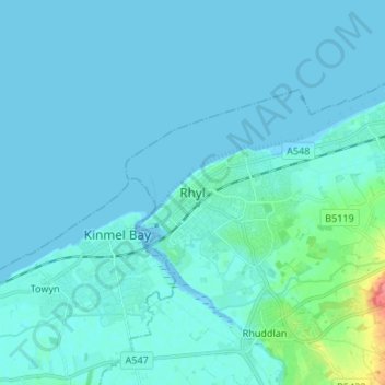
Name: Rhyl topographic map, elevation, terrain.
Location: Rhyl, Denbighshire, Wales, LL18 1RG, Vereinigtes Königreich (53.28074 -3.53073 53.36074 -3.45073)
Average elevation: 5 m
Minimum elevation: -2 m
Maximum elevation: 59 m
Other topographic maps
Click on a map to view its topography, its elevation and its terrain.
Moel Fferna
Vereinigtes Königreich > Wales > Denbighshire
Moel Fferna, Denbighshire, Wales, LL21 9EH, Vereinigtes Königreich
Average elevation: 502 m