
基隆市 topographic map
Interactive map
Click on the map to display elevation.
About this map
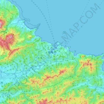
Name: 基隆市 topographic map, elevation, terrain.
Location: 基隆市, 中正區, 基隆市, Taiwan, 20201, Taiwan (24.97172 121.58465 25.29172 121.90465)
Average elevation: 146 m
Minimum elevation: -4 m
Maximum elevation: 1,020 m