
Burg Blankenstein topographic map
Interactive map
Click on the map to display elevation.
About this map
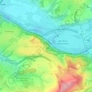
Name: Burg Blankenstein topographic map, elevation, terrain.
Average elevation: 111 m
Minimum elevation: 63 m
Maximum elevation: 207 m
Other topographic maps
Click on a map to view its topography, its elevation and its terrain.
Blankenstein
Deutschland > Nordrhein-Westfalen > Hattingen
Blankenstein, Hattingen, Ennepe-Ruhr-Kreis, Nordrhein-Westfalen, 44797, Deutschland
Average elevation: 107 m