
Dane County topographic map
Interactive map
Click on the map to display elevation.
About this map
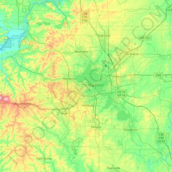
Name: Dane County topographic map, elevation, terrain.
Location: Dane County, Wisconsin, USA (42.84515 -89.83857 43.29416 -89.00883)
Average elevation: 289 m
Minimum elevation: 218 m
Maximum elevation: 477 m
Other topographic maps
Click on a map to view its topography, its elevation and its terrain.
Dodgeville
USA > Wisconsin > Dodgeville
Dodgeville, Iowa County, Wisconsin, USA
Average elevation: 370 m