
Lake Erie topographic map
Interactive map
Click on the map to display elevation.
About this map
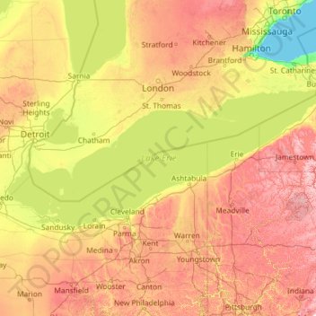
Name: Lake Erie topographic map, elevation, terrain.
Location: Lake Erie, Lake County, Ohio, USA (41.38068 -83.47851 42.90584 -78.84648)
Average elevation: 267 m
Minimum elevation: 72 m
Maximum elevation: 769 m
Other topographic maps
Click on a map to view its topography, its elevation and its terrain.
Burton Lake
USA > Ohio > Burton Lake
Burton Lake, Burton Township, Geauga County, Ohio, 44021, USA
Average elevation: 348 m
New Harrisburg
USA > Ohio > New Harrisburg
New Harrisburg, Harrison Township, Carroll County, Ohio, USA
Average elevation: 354 m