
El Quseir topographic map
Interactive map
Click on the map to display elevation.
About this map
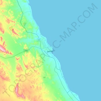
Name: El Quseir topographic map, elevation, terrain.
Location: El Quseir, Red Sea, 84712, Egypt (25.94484 34.11976 26.26484 34.43976)
Average elevation: 69 m
Minimum elevation: 0 m
Maximum elevation: 445 m
Other topographic maps
Click on a map to view its topography, its elevation and its terrain.
Wadi El-Gemal - Hamata National Park
Wadi El-Gemal - Hamata National Park, Red Sea, Egypt
Average elevation: 244 m
Al Qusair City
Egypt > Red Sea > Al Qusair City
Al Qusair City, Red Sea, 84712, Egypt
Average elevation: 47 m