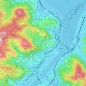
九肚 Kau To topographic map
Interactive map
Click on the map to display elevation.
About this map
Name: 九肚 Kau To topographic map, elevation, terrain.
Average elevation: 110 m
Minimum elevation: -7 m
Maximum elevation: 413 m

Click on the map to display elevation.
Name: 九肚 Kau To topographic map, elevation, terrain.
Average elevation: 110 m
Minimum elevation: -7 m
Maximum elevation: 413 m