
Tangerang topographic map
Interactive map
Click on the map to display elevation.
About this map
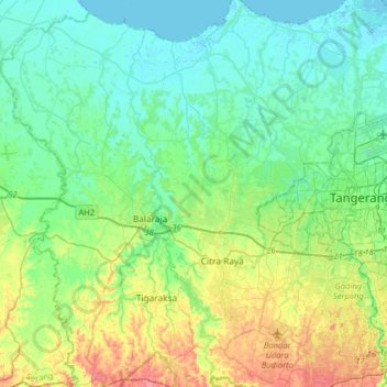
Name: Tangerang topographic map, elevation, terrain.
Location: Tangerang, Banten, 15118, Indonesia (-6.33348 106.33920 -6.01348 106.65920)
Average elevation: 18 m
Minimum elevation: -2 m
Maximum elevation: 64 m
Other topographic maps
Click on a map to view its topography, its elevation and its terrain.