
Nottinghamshire topographic map
Interactive map
Click on the map to display elevation.
About this map
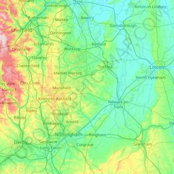
Name: Nottinghamshire topographic map, elevation, terrain.
Average elevation: 74 m
Minimum elevation: -1 m
Maximum elevation: 433 m
Other topographic maps
Click on a map to view its topography, its elevation and its terrain.
Nottingham
Vereinigtes Königreich > England > Nottinghamshire
Nottingham, Nottinghamshire, England, Vereinigtes Königreich
Average elevation: 56 m