
Kampung Pagi topographic map
Interactive map
Click on the map to display elevation.
About this map
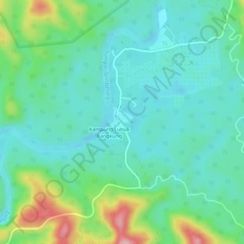
Name: Kampung Pagi topographic map, elevation, terrain.
Location: Kampung Pagi, Jerantut, Pahang, Malaysia (4.42773 102.46337 4.46773 102.50337)
Average elevation: 124 m
Minimum elevation: 67 m
Maximum elevation: 298 m