
Reykjanesbær topographic map
Interactive map
Click on the map to display elevation.
About this map
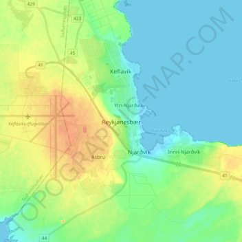
Name: Reykjanesbær topographic map, elevation, terrain.
Location: Reykjanesbær, Southern Peninsula, 260 KEIFLAVÍK, Iceland (63.94327 -22.59615 64.02327 -22.51615)
Average elevation: 21 m
Minimum elevation: -1 m
Maximum elevation: 70 m