
Mile End topographic map
Interactive map
Click on the map to display elevation.
About this map
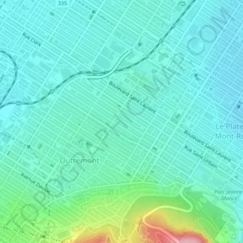
Name: Mile End topographic map, elevation, terrain.
Average elevation: 81 m
Minimum elevation: 51 m
Maximum elevation: 210 m
Other topographic maps
Click on a map to view its topography, its elevation and its terrain.
Côte-des-Neiges–Notre-Dame-de-Grâce
Côte-des-Neiges–Notre-Dame-de-Grâce, Montreal, Urban agglomeration of Montreal, Montreal (06), Quebec, Canada
Average elevation: 68 m
Ville-Marie
Ville-Marie, Montreal, Urban agglomeration of Montreal, Montreal (06), Quebec, Canada
Average elevation: 30 m