
Krasice topographic map
Interactive map
Click on the map to display elevation.
About this map
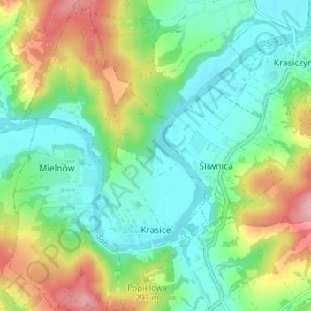
Name: Krasice topographic map, elevation, terrain.
Average elevation: 257 m
Minimum elevation: 200 m
Maximum elevation: 374 m
Other topographic maps
Click on a map to view its topography, its elevation and its terrain.
Krasiczyn
Poland > Subcarpathian Voivodeship > Przemyśl County > Krasiczyn
Krasiczyn, gmina Krasiczyn, Przemyśl County, Subcarpathian Voivodeship, 37-741, Poland
Average elevation: 274 m