
La Grande Écluse topographic map
Interactive map
Click on the map to display elevation.
About this map
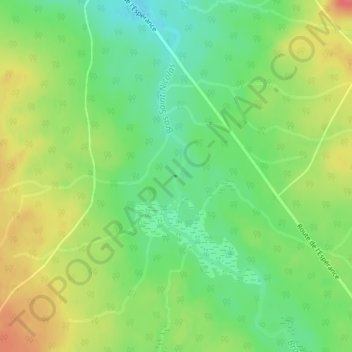
Name: La Grande Écluse topographic map, elevation, terrain.
Average elevation: 368 m
Minimum elevation: 340 m
Maximum elevation: 401 m
Other topographic maps
Click on a map to view its topography, its elevation and its terrain.
Cap-Saint-Ignace
Canada > Québec > Cap-Saint-Ignace
Cap-Saint-Ignace, Montmagny (MRC), Chaudière-Appalaches, Québec, G0R 1H0, Canada
Average elevation: 18 m