
Herm topographic map
Interactive map
Click on the map to display elevation.
About this map
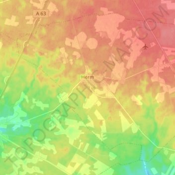
Name: Herm topographic map, elevation, terrain.
Average elevation: 57 m
Minimum elevation: 18 m
Maximum elevation: 86 m
Other topographic maps
Click on a map to view its topography, its elevation and its terrain.
Aire-sur-l'Adour
France > Nouvelle-Aquitaine > Landes
Aire-sur-l'Adour, Mont-de-Marsan, Landes, Nouvelle-Aquitaine, Metropolitan France, 40800, France
Average elevation: 122 m